
Most of the Yukon Territory’s wealth is now measured by mountains and rivers and scenic views.
By Mark Stevens
August 2019
Skookum Jim Mason, Dawson Charlie, and George Carmack discovered gold along Rabbit Creek, a tributary of the Klondike River, in August 1896. They turned Canada’s Yukon Territory into a destination for thousands who sought their fortune.
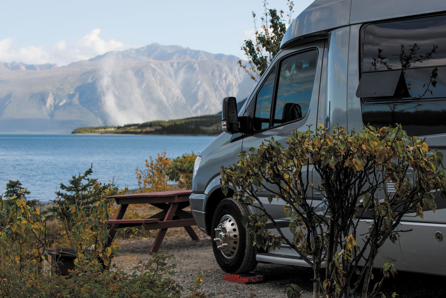
A serene campsite view at Cottonwood Park.
They scrambled up Chilkoot Pass; they braved the Yukon River; they traveled by water and they traveled by land. Today you can follow the land route in your RV and relive history — and discover treasure, too.
Cruise roads that wind past grizzly bears, perhaps some caribou, or a family of deer. Negotiate valleys sheltered by mountains higher than the Rockies; pull up to your campsite beside a lake and stare at glaciers. In short, you can travel through some of the most breathtaking landscapes Canada offers.
The Yukon
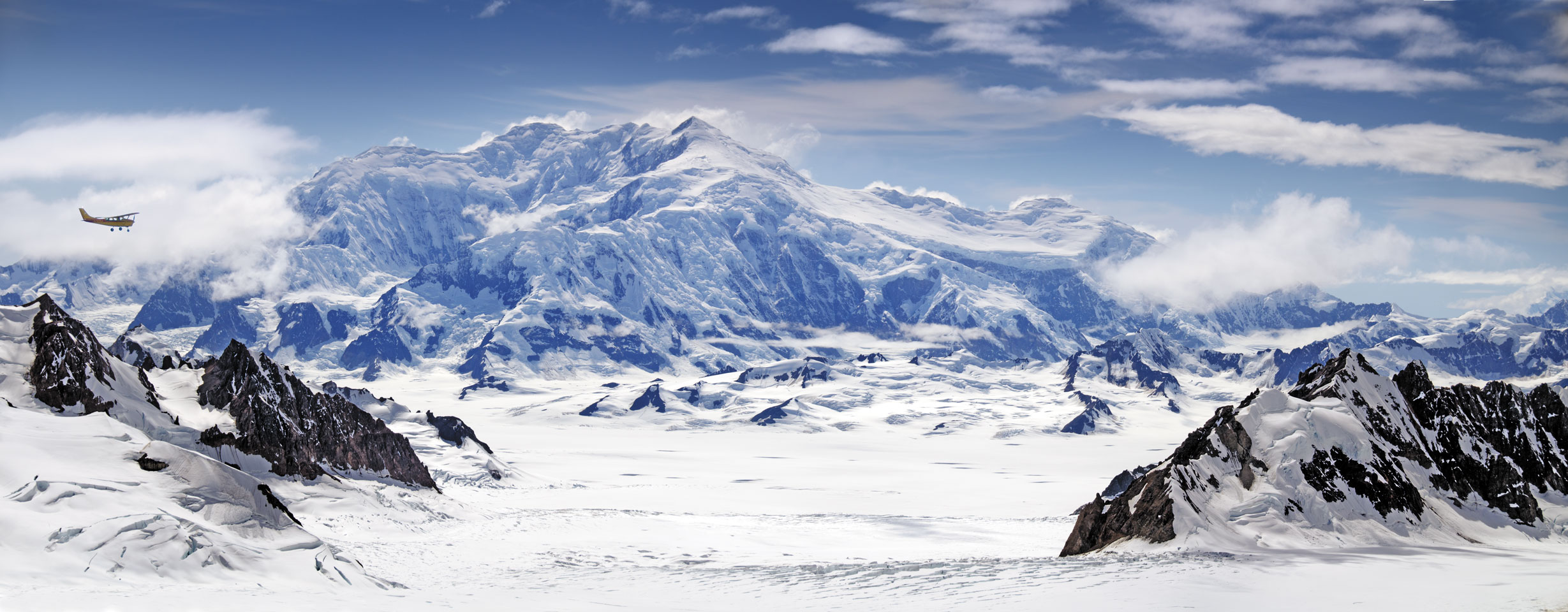
This triangle-shaped area shares a border with Alaska to the west and Northwest Territories to the east. From south to north, it stretches from British Columbia to the Beaufort Sea. It’s an area of superlatives. A former travel bureau motto for the Yukon was “Larger than Life,” and it IS big. Almost as big as Spain or Sweden, it has nine of the 10 tallest mountains in Canada, the world’s smallest desert, and the biggest nonpolar ice fields in the world.
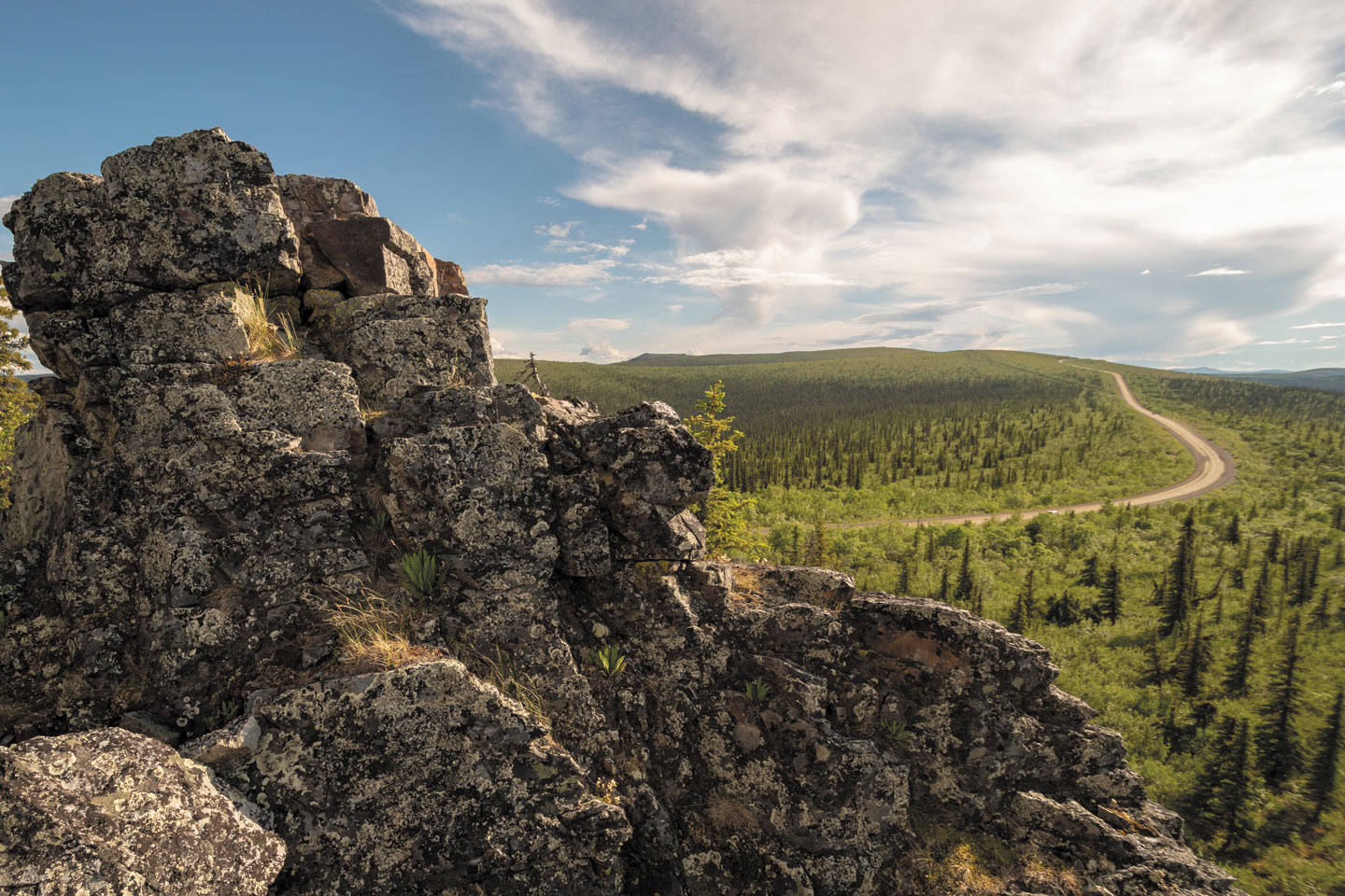
But its population is approximately 39,000, lower than the entire number of people in the town of, say, Concord, New Hampshire. That means when you traverse the byways of the Yukon, you’ll share the roads with almost no one. In a drive of two hours you might see three or four other vehicles. Best yet, you’re likely to get your choice of campsites at the end of the day.
Route 1, The Road To Kluane
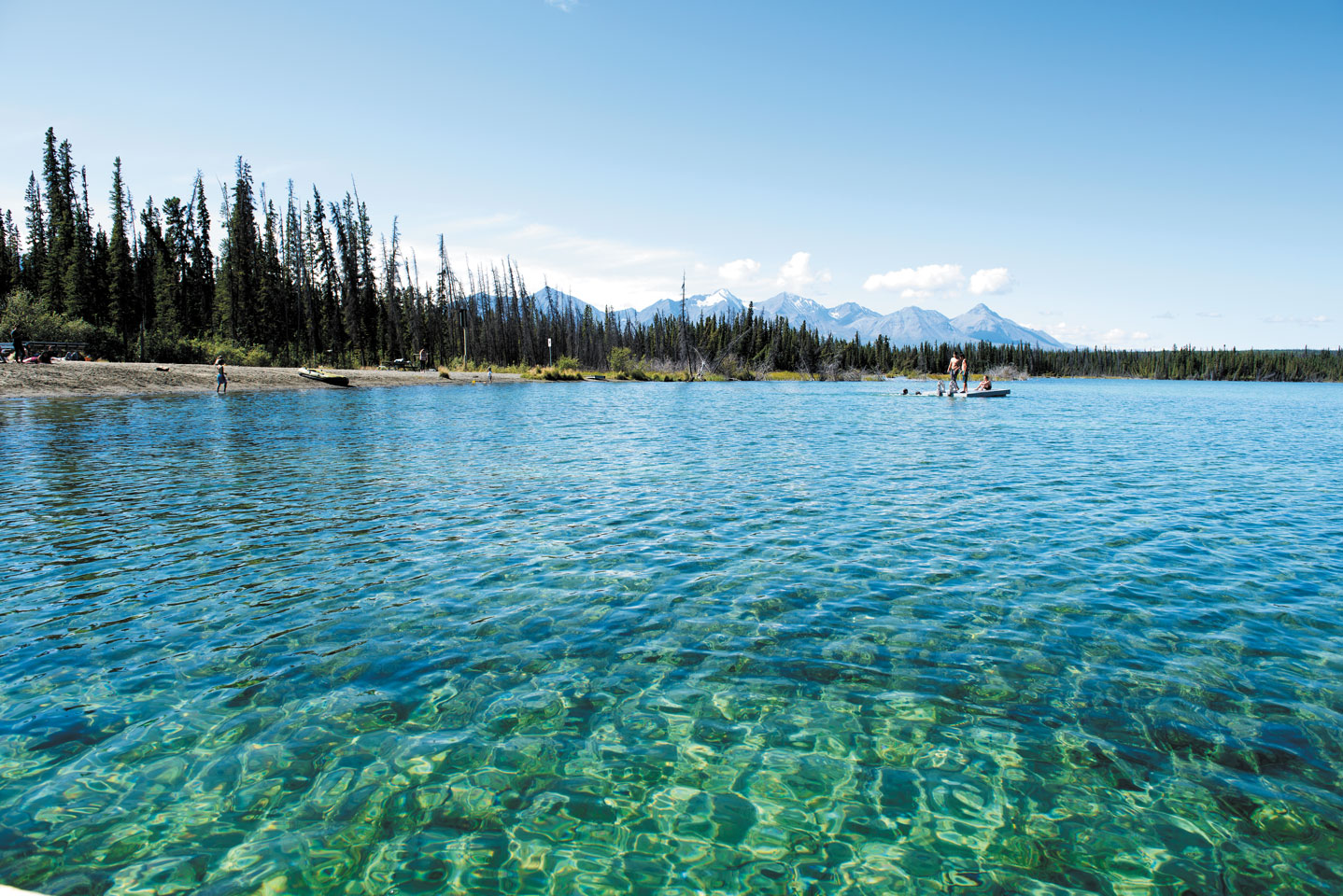
The beauty of Pine Lake can entice RVers to stay awhile at the primitive government-run campground there.
From Whitehorse, in southern Yukon, Route 1 travels west and north. On this road you pass three or four distinct mountain ranges as you drive roughly 100 miles to Haines Junction. Just north of Haines Junction is Pine Lake Campground, which offers large sites (several drive-through) beside a crystal-clear lake with a tiny beach and spectacular views of snowcapped mountains.
Welcome to a huge Yukon selling point for RVers. In addition to a number of privately maintained RV parks, the government offers more than 60 road-accessible campgrounds like Pine Lake. Though facilities are rustic at best (pit toilets), many of these are in scenic locations and boast several drive-through sites.
Pull in at Pine Lake and sun awhile and you may never want to leave. Which would be a mistake.
At Haines Junction, head to the Da Ku Cultural Centre, which celebrates the culture and traditions of the Champagne and Aishihik First Nations people. It also is the visitors center for Kluane National Park and Reserve, which is part of a park system designated a UNESCO Heritage Site. The center houses a three-dimensional topographic map of this huge preserve, as well as videos, exhibits, and hands-on activities.
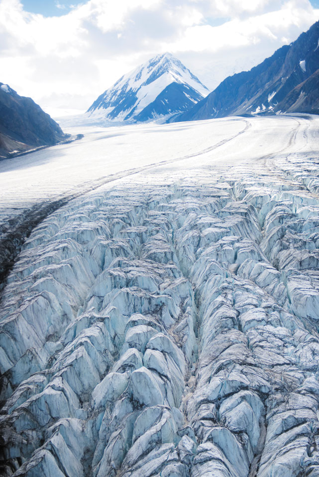
At Kluane (pronounced clue-ON-ee), you can hike along the Alsek River, and possibly see bears or moose. Check the riverside for traces of grizzlies or take a gentler stroll with breathtaking views of the St. Elias mountain range, Canada’s highest. Flight-seeing tours also are offered, with Icefield Discovery tours landing right on the ice fields, letting visitors explore for a few hours or a few days.
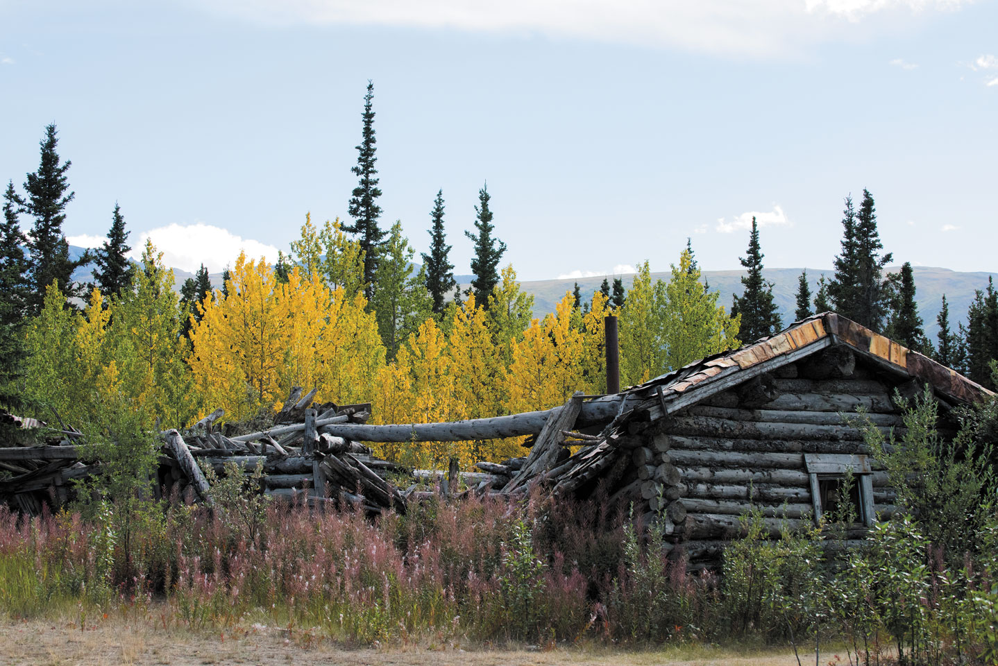
The remains of a mining town called Silver City can be explored on the way to Kluane Lake.
On the way to Kluane Lake, make a little side trip to Silver City, a real-life ghost town. Stop for the night at Cottonwood Park (www.cottonwoodpark.ca; 867-841-4066), a sprawling lakeside property with views of the glaciers to the south, the lake itself with its rolling waves, and more mountains across the way. Some sites are 20 feet from a pebble-strewn shore. This is a remote spot.
Stroll the beach of the Yukon’s largest lake or just pull up a chair and watch the sunset paint the slopes of Ruby Range a blushing pink.
North or East? From here, you can continue traveling north via Route 1, passing through Alaska and then back over into Yukon on the Top of the World Highway until you reach Dawson City. However, a few caveats: 1. The road is narrow and not always paved. 2. Serious rains can make this route treacherous, and the highway is a mix of twists, turns, and switchbacks. 3. The drive will make your trip longer and will take more from your fuel budget.
The alternative is to go back east to Whitehorse and see the capital of the Yukon. From there, drive straight on up Route 2 to Dawson City.
Whitehorse
Whether you fly into Whitehorse and book a rental RV, or chauffeur your own RV north, this is the place for provisioning and orientation.
During their journey toward the goldfields outside Dawson City, prospectors had to negotiate the rapids of the Yukon River near what is today the Yukon’s only city, stopping to regroup at an erstwhile way station on a cliff overlooking the river.
Nowadays those rapids, said to resemble the manes of white horses, exist only in memory. And in the name Whitehorse, of course.
The guaranteed prize in Yukon Territory is the scenery, such as this view in the Kluane region.
About 18 miles outside town is Takhini Hot Springs, which has an RV park with electrical hookups and pull-through sites (Hot Springs Campground & Hostel: 867-456-8004; https://yukoncampground.com). It’s the ideal base from which to explore this area. From there you can walk along a path in the evening mist to a natural hot springs and soak up warm, healing mineral waters (107 degrees Fahrenheit) in two outdoor pools. Campers get a discounted admission to the springs.
It’s a short drive from the RV park to the Yukon Wildlife Preserve. Take one of two self-guided tours through a landscape of lowlands, rock cliffs, rolling hills, and wetlands, studying animals ranging from wood bison to arctic foxes in their natural habitats.
The Top of the World Highway offers Yukon travelers an alternate way to reach Dawson City.
Discover the history of the area at the newly expanded MacBride Museum in Whitehorse (where you can get your first lesson in panning for gold), then climb aboard the restored Yukon steamship S.S. Klondike, a National Historic Site dry-docked on the banks of the Yukon River.
For a pleasant day trip from Whitehorse, go south to the charming and scenic village of Carcross. It’s about 45 miles from Whitehorse, at the end of Lake Bennett, where prospectors began the next leg of their journey north. Get the latest info on what’s happening by going first to the visitor information center. You may like the idea of seeing historic buildings in the self-guided walking tour, or checking out First Nations artwork in boutiques at Carcross Commons. Another popular emporium is the Matthew Watson General Store. Plus, if the weather’s nice, you can stroll along Lake Bennett.
Don’t miss the surreal sand dunes of the “Carcross Desert,” said to be the world’s smallest desert. Actually, it’s a square mile of sand left over from a glacial riverbed, but that in itself is unusual.
Striking Gold In Dawson City
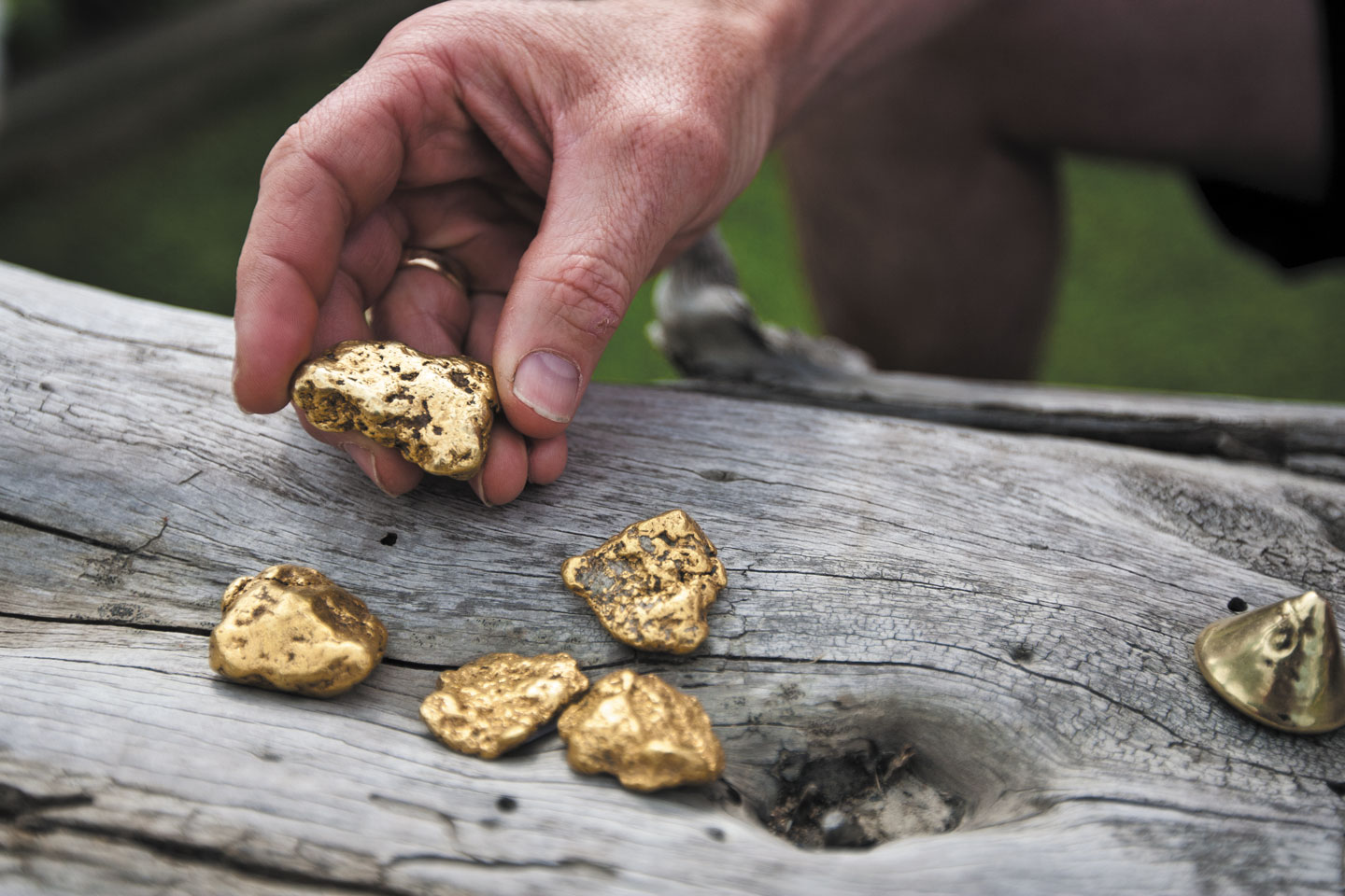
Around Dawson City, gold-panning operators help tourists hit the jackpot for themselves.
The biggest stretch of your adventure, where you will channel the hopes and dreams of those in search of gold at the end of the road, is Dawson City. The seven-hour, 333-mile drive from Whitehorse to Dawson City is a gorgeous route. You may need to get sustenance for it only a few miles north of Whitehorse at a roadhouse called Braeburn Lodge. In addition to regular meals, the restaurant serves renowned, plate-sized cinnamon buns.
Other good stops are Fox Lake Burn Rest Area, which has a hiking trail through the remnants of a forest fire, and a trail at Five Finger Rapids, with its panoramic view of the Yukon River.
But the drive is worth it, as you’ll discover from your base at Gold Rush Campground, in downtown Dawson City (867-993-5247; https://goldrushcampground.com). From there, you can stroll to everything around town but the actual goldfields themselves. It’s not the only RV park in this area, so you may want to check online if you have other preferences.
At a little park outside Dawson City, tourists can pan for gold at the very birthplace of the Klondike River. Claim 33 is an actual working claim where you’ll get a lesson in panning for gold with a guarantee of getting some (though hardly enough to buy that next RV).
It is easy to feel lost in time in Dawson City, where buildings are either originals or historically accurate reproductions. The entire town is a National Historic Site. Most buildings have that same boomtown look seen in other kinds of quickly built places from a century ago. Canadian parks employees provide guided walking tours; afterward, you can stop and reflect at the Jack London homestead.
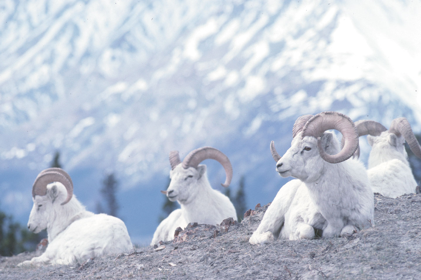
Yukon travelers often view Dall sheep.
Then, after dinner, stroll downtown and take in a show featuring Diamond Tooth Gertie herself, trying for luck of a different sort at Diamond Tooth Gertie’s Saloon and Casino. And if your sense of adventure hasn’t yet been satisfied, hit the saloon at Downtown Hotel (a place that looks like the setting for a Western movie) and join a rather unique fraternity. Sip a shot of liquor with a human toe in it, and you can join the Sourtoe Cocktail Club.
Next morning, we explored First Nations culture at the Dänoja Zho Cultural Centre. And while heading back south, we noted a collection of pioneer cemeteries that tell their own stories of this fascinating place.
Between the stunning natural beauty of the Yukon, the human history, and the modern and quirky nightlife in Dawson City, it seems this place is every bit as freewheeling as it was 12 decades ago when someone first yelled “Eureka!”
Resources
Yukon Travel Guide
(800) 661-0494
The Milepost (travel guidebook)
(800) 726-4707
Government of Yukon Campgrounds
(867) 667-5648
www.env.gov.yk.ca/camping-parks/campgrounds.php
Use the above site for campgrounds like Pine Lake, mentioned in the story.
Canada RVing Guide From Go RVing Canada