
Southern California’s desert secrets are revealed here to those who visit with or without a four-wheel-drive vehicle.
By Mary Taylor, F480792
February 2019
Adventuresome travelers will love Mojave National Preserve. Sand dunes, lava beds, desert washes, and narrow slot canyons fill the landscape. A historical train depot reveals a part of the past. And if you bring along a four-wheel-drive, high-clearance vehicle, options include traversing a dirt road that once was an Indian trail.
Adventuresome or not, you also will relish leisure time in a campground surrounded by volcanic rock walls with a view that stretches to the horizon.
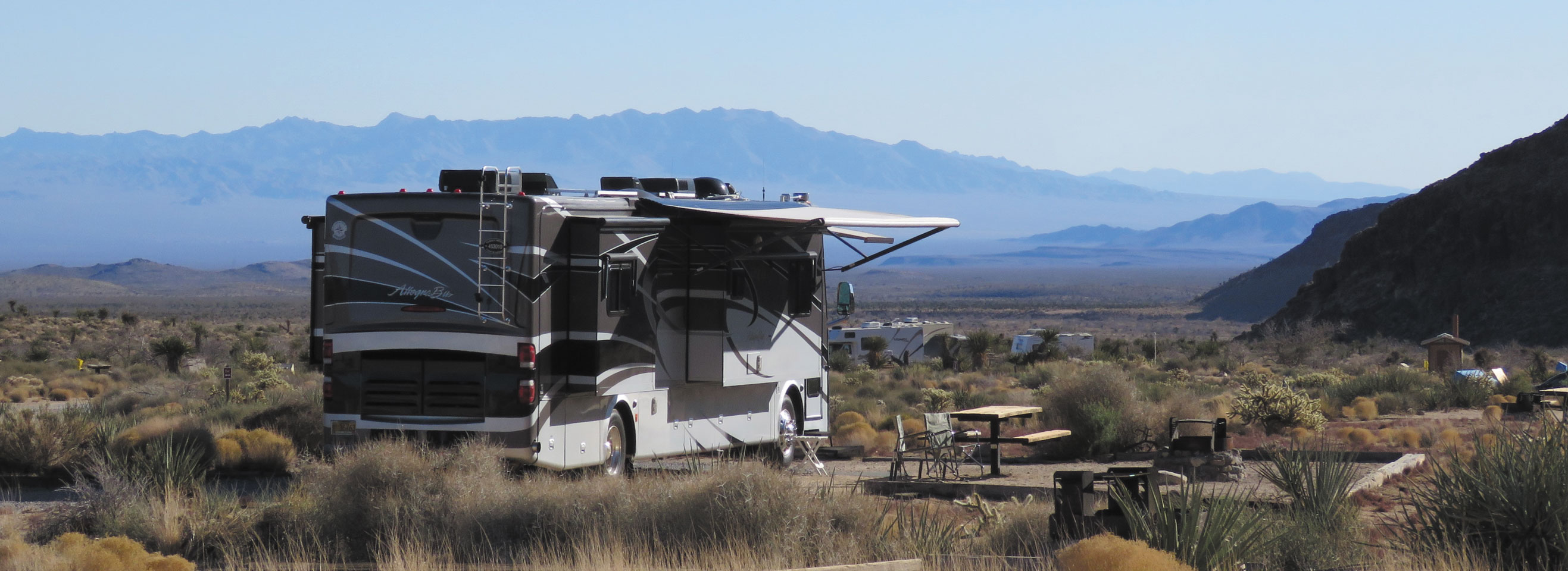
Mojave’s Hole-in-the-Wall Campground is available on a first-come, first-served basis and costs $12 per night; fees are $6 for holders of the many types of America the Beautiful passes.
The Mojave National Preserve in Southern California is close to several spots that are popular among snowbird RVers. We had been driving past it for several years before we finally explored it. Once we did, we came away absolutely stunned by its desert beauty and the variety it offered
This 1.6-million-acre preserve managed by the National Park Service lies about an hour south of Las Vegas, Nevada. It is bordered to the north by Interstate 15 (a small portion of it is north of there) and to the south by Interstate 40. Find Death Valley National Park on a map and look southeast, and you’ll see this lesser-known gem.
Terrain varies in elevation from 800 feet to about 7,900 feet, with corresponding changes in vegetation and birds and animals. But more notable than its physical variation is the history it contains and the multitude of activities it offers.
History Of The Land
The area making up the Mojave National Preserve had an unusual history before coming under the control of the National Park Service and the Bureau of Land Management.
The first occupants were American Indians. Next came the American military, protecting prospectors, miners, and then ranchers, farmers, and homesteaders. Even railroads came to cross that desert landscape. With the variety and intensive use of the land, it could prove difficult to make it a park.
But, efforts to do so began in 1980. It was 1994 before the passing of legislation that created the preserve, and even then, budget challenges left the National Park Service with only $1 to administer the preserve. The balance of the appropriation went to the BLM to manage the area in a multiple-use fashion. Finally, by 1996 the completed plan and budget were passed.
According to one history of the Mojave, by the time the park was established, 15,000 mining claims had been staked in the area, and 3,000 were active claims. More than 400 abandoned mine sites existed, and grazing was still permitted. In addition to the railroad, petroleum pipelines and high-tension power lines ran through the area. Today, freight trains still use the track next to the old Kelso Depot.
A Preserved Depot
Since 2005, the Kelso Depot has served as the largest visitors center for Mojave National Preserve. It is a do-not-miss place.
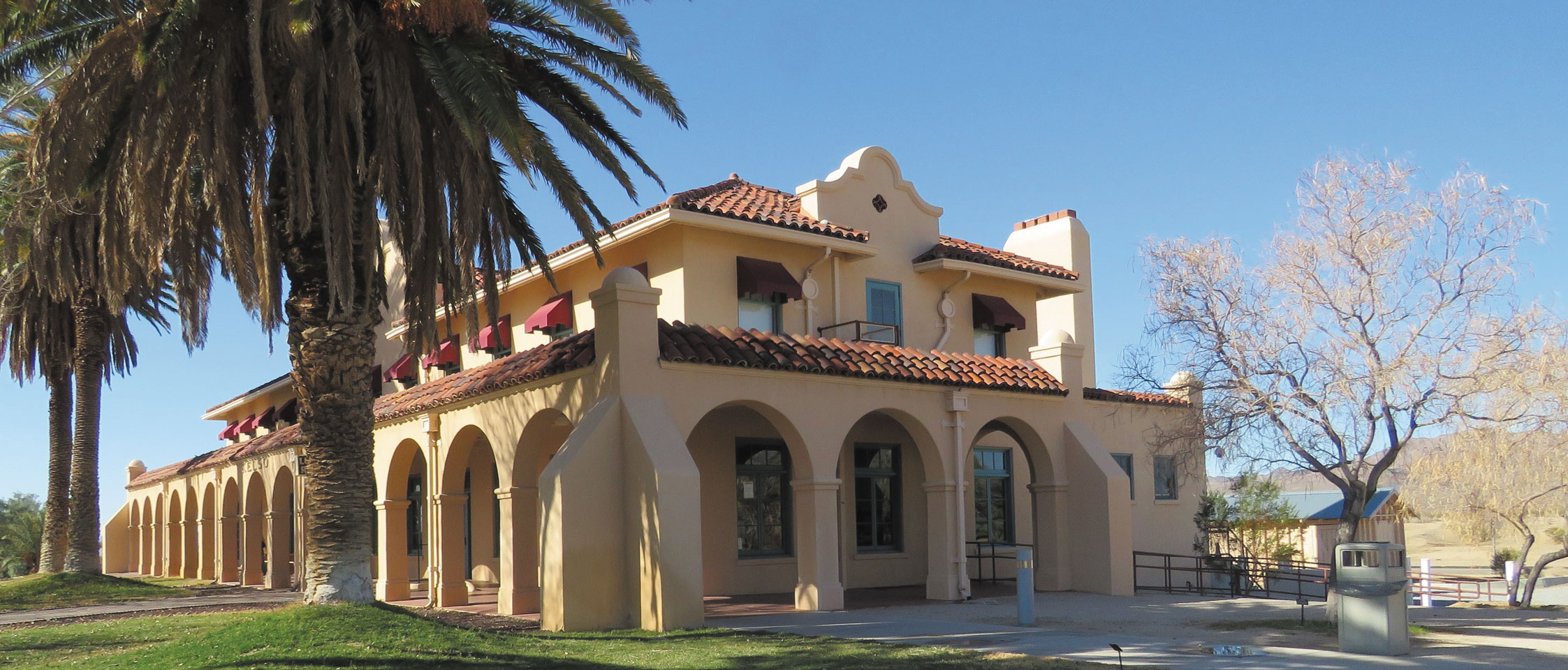
Trains still trundle past the Kelso Depot, a 1924 hub that has been restored to its former grandeur. Inside is a small museum, a restored lunch counter, and a visitors center.
The original train depot was built in 1905. This much larger, beautiful building opened in 1924. It contained small overnight rooming spots for train employees upstairs, while downstairs it had offices, a restaurant, and more to serve passengers.
The town of Kelso thrived, especially during World War II. But by 1985 Union Pacific Railroad was planning to tear down the depot. With the help of architecture aficionados and funding from the National Parks Conservation Association, the building was restored.
Come inside to admire the work and to see the small museum that highlights the land’s creatures and its history. A 20-minute video about the site runs continuously, and you can admire the U-shaped lunch counter that once served visitors. The train station visitors center is open Thursday through Monday (closed Tuesdays and Wednesdays) from 10:00 a.m. to 5:00 p.m.
Roads For Four-Wheeling
The preserve has several major paved roads everyone can use; some, such as Cima Road, Kelso-Cima Road, and Kelbaker Road, traverse the entire park from north to south. Dirt include Cedar Canyon Road, Wildhorse Canyon Road, and Aiken Mine Road. For most of the dirt roads, high-clearance, four-wheel-drive vehicles are recommended. The park website notes that visitors should not travel alone and should not count on cell phones to work in this area. Updates and current information about road conditions should be obtained before you drive on any of the park’s dirt roads.
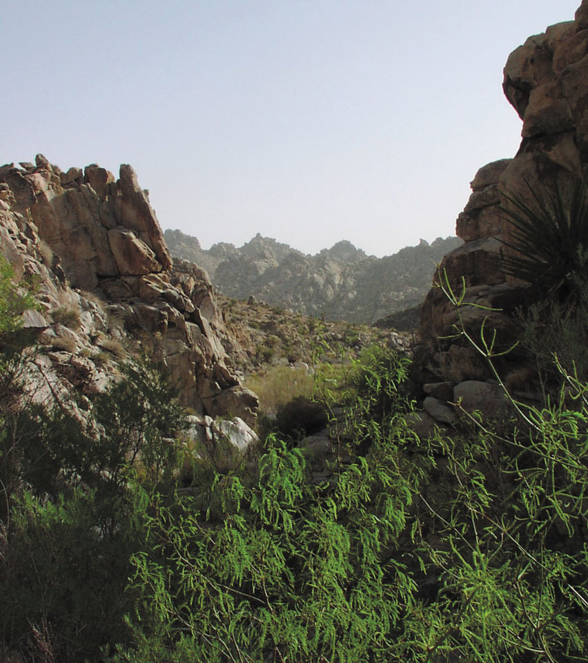
Green willows grow near the park’s Basalt Spring.
One popular four-wheel-drive, high-clearance trail is Mojave Road, a sandy dirt path that traverses about 140 miles across the preserve. It began as a Mojave Indian trail and eventually became a wagon road when forts were built during the mid-1800s to protect wagon traffic. It never became a major immigrant trail but was heavily used as a military, freight, and mail road until the late 1800s.
Be sure to purchase Mojave Road Guide — An Adventure Through Time by Dennis G. Casebier. Not only is it a mile-by-mile guide, but it includes an extensive history of the road, plus maps and some historic photos. Based on our short excursion on Mojave Road, I wouldn’t leave home without the book. It’s available from online retailers.
Rock House
We were exploring the area near Cedar Canyon Road and Mojave Road looking for trailheads and historic springs when we found a compact rock house sitting in the middle of nowhere.
Why is a rock house out there? After World War I, a veteran by the name of Bert Smith was looking for a place where he could settle. He had suffered lung injuries from the war and found the area to be inexpensive and good for his health. He settled on a plot of land and built the rock home in 1929, adding corrals for several goats. For a man who wasn’t expected to live long, he not only established this little ranch but lived there for 25 years. It’s just off a paved section of the Mojave Road and is worth checking out. There’s a hiking trailhead nearby and also a chance to hike or drive a short distance to see Rock Springs, one of the old military springs from the 1860s.
National Natural Landmarks
A couple other areas we checked out were Kelso Dunes and Cima Dome.
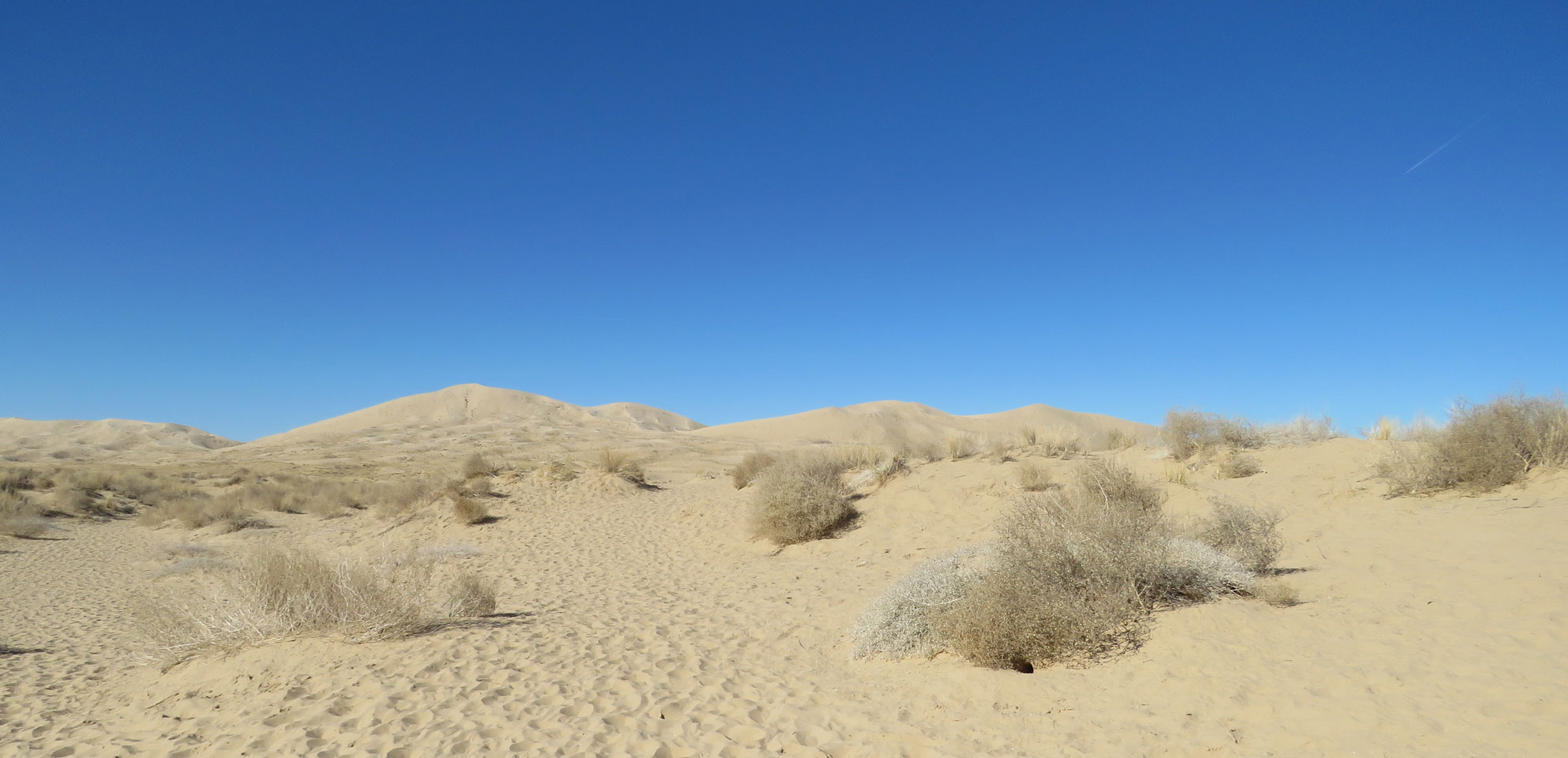
The sand dunes are just south of Kelso Depot off Kelbaker Road and cover a 45-square-mile area. The highest dune is about 600 feet above the desert floor. The dunes are called singing dunes, as they emit sounds variously described as squeaking or booming, caused when the sand shifts and moves. The trailhead is obvious, but the 3-mile round-trip trail can become vague because of ever-shifting sands. Personally, I stopped when the walking became a sandy drudge once I got into the bigger dunes.
Cima Dome, one of the National Natural Landmarks at Mojave.
Cima Dome is one of the preserve’s National Natural Landmarks. Its broad, symmetrical slope reaches 1,500 feet above the surrounding terrain, and it covers almost twice the area of the sand dunes. Our best look at it was during our Teutonia Peak hike, for it provides a really good perspective on the size of the mound.
Adjacent and southwest of the dome is the Cima Volcanic Field and Range. We ran out of time to see this, but it contains cinder cones, lava flows, and a lava tube you can enter if you want to truly experience all that the preserve has to offer. They are both off Kelbaker Road, but it’s recommended that you have a high-clearance vehicle if you wish to visit them.
Hikes
Many hiking trails are available at Mojave. We took two trails directly from our spot at the Hole-in-the-Wall Campground, and one north of Cima (once a small community and now merely an intersection).
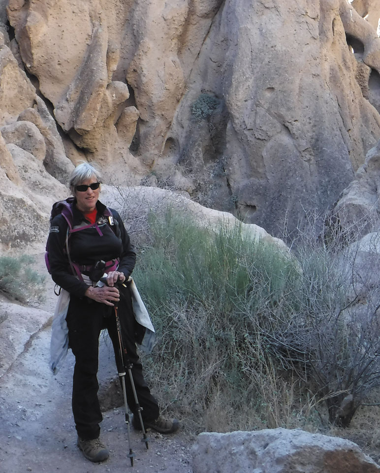
The author while hiking on the Barber Peak Loop Trail.
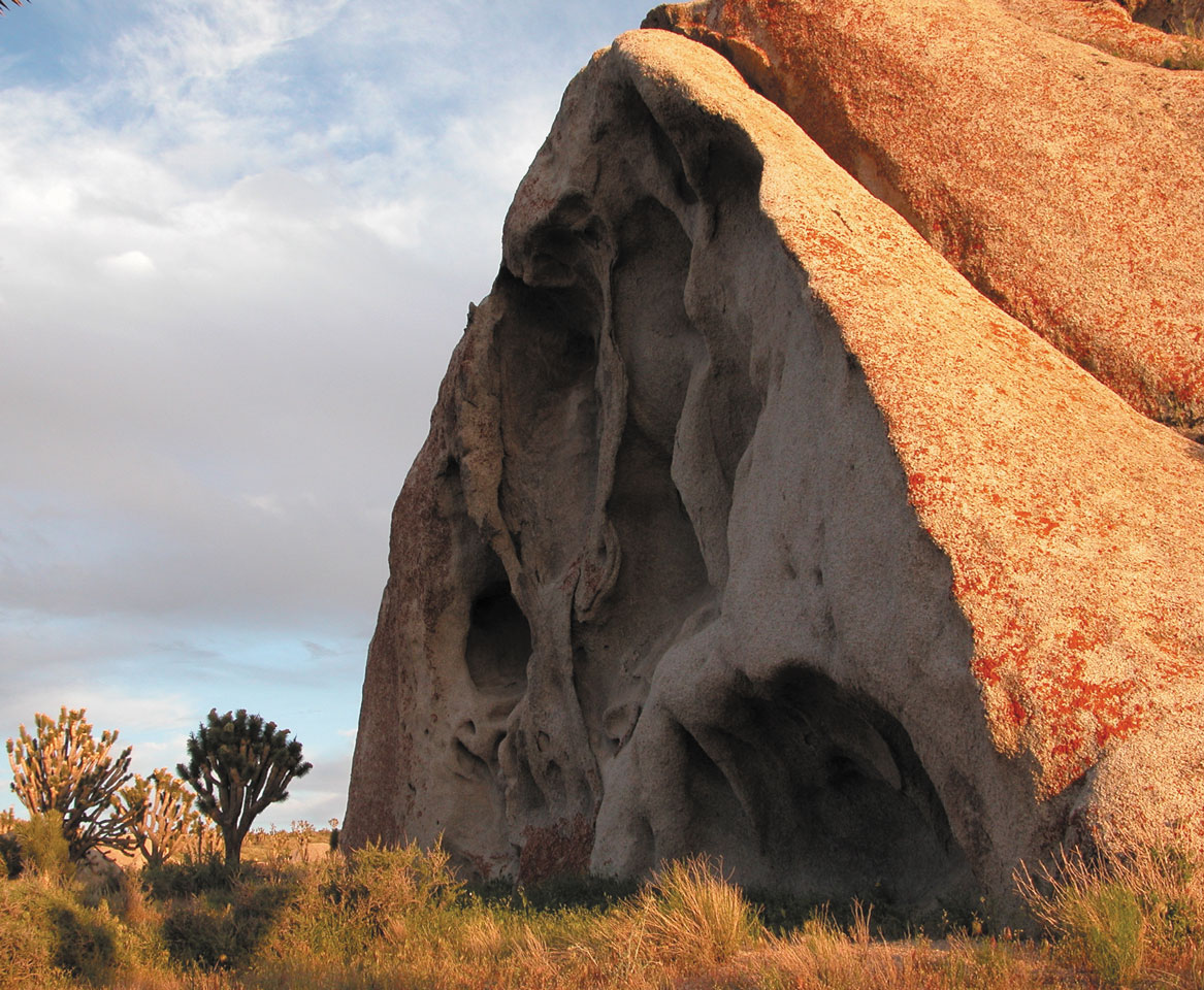
Barber Peak Loop Trail circles the butte next to Hole-in-the-Wall Campground and is not arduous. As it heads north, you experience terrain that becomes more populated with barrel cacti, Joshua trees, and chollas. Between a recent flash flood down the washes when we were there and a very large wildfire in 2005, which devastated most of the juniper trees, you can see how fragile the desert is. Because of the destruction from the washout, we missed one of the trail markers and finished the 6-mile hike on an alternate ending. This made it easier, but this route was not nearly as interesting as the correct way.
We should have finished the Barber Peak Trail via the Rings Loop Trail. The latter is only a 3-mile section, but by approaching it on a separate hike, we had a much different experience. Sets of rings and pins help hikers through a couple of narrow, steep sections. It would have been much easier if we had been going up the trail so we could have used the rings, rather than awkwardly squeezing our bodies downward.
Our third hike was northwest of Cima at the Teutonia Peak Trail. The initial section was gentle and wound through a Joshua tree forest and several deserted mines. Once you reach the saddle, you are on the steeper section, with stone steps up to the switchbacks. The views from the 5,700-foot peak include the Cima Dome, desert landscapes, and even Interstate 15 far off in the distance.
The Mid Hills Trail connects the Mid Hills Campground with Hole-in-Wall. This trail is 8 miles long and goes through a maze of washes containing chollas and barrel cacti. Depending on your direction, it has a 1,200-foot elevation gain or loss.
Campgrounds
If you take the southern approach to the preserve via Interstate 40, you will be near two campgrounds, but only one is accessible to RVs. They are located off the preserve’s Essex/Black Canyon Road entrance. Both are relatively primitive, without any services other than clean outhouses. Picnic tables and fire rings are available in each spot.
The Hole-in-the-Wall Campground is one of the two. It has 35 sites; many of them can handle larger RVs. The view across the valley to distant mountains from the upper sites is impressive.
Farther up Black Canyon Road (which by then is a dirt road) is Mid Hills Campground. The dirt access road is not recommended for travel trailers or motorhomes.
Also on Essex Road is Providence Mountains State Recreation Area, which is part of the California State Park system. No camping is available there because of its limited hours.
Mitchell Caverns Tours
Providence Mountains State Recreation Area is home to Mitchell Caverns, a limestone cave system. The caverns are named after Jack and Ida Mitchell, who ran a resort there from 1934 to 1954. As part of the resort experience, they conducted tours of the caverns. The caves have spectacular limestone formations; they include the stalagmites and stalactites, plus lily pads, draperies, curtains, and cave coral.
Because the recreation area is open only Friday through Sunday (plus holiday Mondays), reservations for the cavern tour are a necessity. Two tours are conducted on those days (except in the heat of summer, when only one tour a day is offered) and require a 1.5-mile strenuous round-trip hike to reach the cavern. The tour is one hour and is limited to 15 people. Reservations are difficult to secure, so be sure to call well in advance: (760) 928-2586. Phone reservations are taken Mondays only, 8:00 a.m. to 5:00 p.m. Tours cost $5 for seniors and $5 for children (16 and under); $10 for adults.
Movement through the caverns can be challenging, because of the sizes of some of the formations; you must be able to make it through areas as low as 62 inches and as narrow as 14 inches. Pets are not allowed to be left unattended in vehicles and they cannot be taken into the caves or on the trails. See the website at www.parks.ca.gov/?page_id=615 for more information.
Visit Soon
Mojave National Preserve offers more variety than many parks you might visit in Southern California. We waited way too long before stopping there — don’t make the same mistake!
Fees: No entry fee is taken at Mojave National Preserve. Campground spaces are first-come, first-served; no reservations are accepted. Fees are $12 per night; $6 for America the Beautiful Senior/Access Pass holders.
Details:
Mojave National Preserve: www.nps.gov/moja; (760) 252-6100.